Área de identidad
Código de referencia
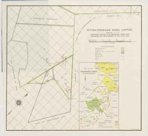
ZA HPRA A1138-H-312-312.2
Título
Plan of Houtpoort section with boreholes, shafts and underground development
Fecha(s)
- 30 June 1936 (Creación)
Nivel de descripción
Unidad documental simple
Volumen y soporte
Extent1 map
Área de contexto
Nombre del productor
(1902-1969)
Institución archivística
Historia archivística
Origen del ingreso o transferencia
Área de contenido y estructura
Alcance y contenido
Also included on the right hand side is a Key Plan indicating neighboring areas with reference to Producing and Developing Gold Mines situated around the Witwatersrand Nigel gold mine. Further included reference to Proclaimed ground, owned, Mineral rights, owned, Townships and Government ground not presently owned, and Freehold owned.